The Juanita Brooks Lecture Series
The 12th Annual Lecture
In Search of the Spanish Trail
By C. Gregory Crampton & Steven K. Madsen
Published by Dixie College
St. George, Utah
About Juanita Brooks
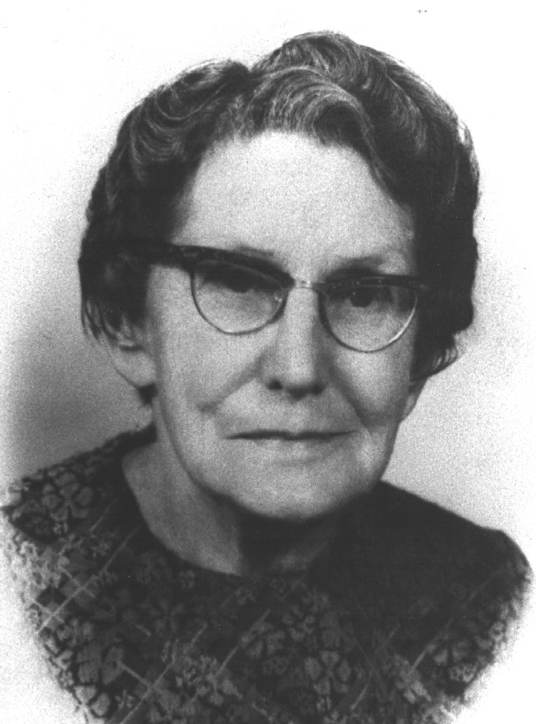
Juanita Brooks was a professor at Dixie College for many years and became a well-known author.
She is recognized, by scholarly consent, to be one of Utah’s and Mormondom’s most eminent historians. Her total honesty, unwavering courage, and perceptive interpretation of fact set more stringent standards of scholarship to emulate. Dr. Obert C. and Grace Tanner had been lifelong friends of Mrs. Brooks and it was their wish to perpetuate her name through this lecture series. Dixie College and the Brooks family express their thanks to Dr. and Mrs. Tanner.
In Search of the Spanish Trail
CRAMPTON: Dr. Alder, Ladies and Gentlemen,
We are pleased to pay our respects to the name of Juanita Brooks and to speak in this historic building.
Tonight, we want to throw some light on one of the early chapters in the history of southern Utah and its region. Not the earliest. The anthropologists have written of the Indian peoples who were living here centuries before the first Europeans arrived. The Spanish approaches came from the south.
MADSEN: Spain, you will recall, following the discoveries of Columbus, overran the Americas with amazing speed. Coronado’s men reached the south rim of the Grand Canyon within fifty years of Columbus’ first landfall. Colonization followed exploration. Juan de Oñate planted a settlement in New Mexico in 1598. Later colonies were planted in Texas and California. As Spain was challenged in North America by other European powers and by native peoples, she attempted to fill in the wide gaps between these fingers of settlement. Dominguez and Escalante in 1776 tried, but failed, to bridge the gap between New Mexico and California.
In 1776, Spain’s power in the New World was beginning to fade, and her possessions in North America were soon lost to revolutionaries who created independent Mexico in 1821. While Spain had closed the doors to international commerce in her possessions in North America, Mexico opened them. Thus, commerial traffic over the Santa Fe Trail between the United States and New Mexico began in 1822.
California ports were also opened to international traffic. The commencement of trade between the Mexican provinces of New Mexico and California was stimulated by this new, international outlook. New Mexico was sheep country, and had been so as a Spanish colony. Wool from churro sheep and woven textiles, which had been major items of trade between New Mexico and the older settlements, now became principal items of commerce between New Mexico and California, which prospered under a booming international market. Horses and mules, abundant in pastoral California, were in demand in New Mexico, while cattle formed the basis in California for a sea-borne commerce in hides and tallow.
With the quickening of international life, the Spanish Trail as we now call it, was opened in 1829–1831 by the Mexican, Antonio Armijo, who in 1829, was the first to carry commercial goods from New Mexico to California. Two Americans, William Wolfskill and George C. Yount, journeyed over the general route of the Spanish Trail in the winter of 1830-1831. Thereafter, the trail became the first major thoroughfare between the provinces of New Mexico and California. In our book, In Search of the Spanish Trail, we have located and mapped the Spanish Trail in detail for the first time.
CRAMPTON: The Spanish Trail was a horse and mule trail, not a wagon road. Goods were transported on the backs of mules. In California, textiles carried over the Spanish Trail were used for clothing, bedding, carpeting, and sacking. Among the woolen items hauled overland were serapes (capes), fresadas (blankets), jergas (carpeting), and sabanillas (sheeting, or homespun coverings). Packers blindfolded the mules to keep them calm as saddles, and bales of wool weighing from 200 to 400 pounds, were loaded on each animal. One mule in each train was packed with a metate, a stone for grinding maize into tortillas. Frijoles (beans), penole (roasted cornmeal), chili colorado (red chili peppers), atole (corn flour gruel), and beef jerky comprised the traders’ daily bill of fare. Pack trains as much as a mile in length, were kept in line by packers and drivers. Sometimes a few resilient women, and children, accompanied the train.
MADSEN: Merchants from New Mexico would leave in the fall before winter snows set in. On reaching California, they exchanged their woolens for mules and horses, some of which may have been stolen. Herds of up to two thousand animals or more were driven from California to New Mexico. Generally, the return trip was made in the early spring to avoid the high water in the Green and Colorado rivers. Each way, the trip took about two and one-half months to complete.
Along the way, the traders sometimes took slaves from the Paiute Indians living in Utah and Nevada, and these were sold in New Mexico and California. In addition to the wool merchants, American traders and trappers, Indians, and a few New Mexican settlers moving to California, used the trail.
CRAMPTON: Of course, the Spanish Trail was not Spanish. It was opened and used during the Mexican period and appropriately should be named the Mexican Trail.
MADSEN: By running northward as far as Green River, Utah, the trail riders avoided the great canyons of the Colorado River, and the hostile tribes on the more direct line through Arizona. In 1848, Mexico lost the region now crossed by the Spanish Trail to the United States; and overland commerce, thereafter, followed direct east-west lines. The Spanish Trail soon ceased to exist as a trade route.
Briefly, following an east-west orientation, the trail ran from Santa Fe, forming a northerly arc that extended to the Green River in Utah, then turned southwesterly to reach the Pacific Coast at Los Angeles. Throughout its length of 1,120 miles, the trail ran through Mexican territory.
In the autumn months, wool traders bound for California departed Santa Fe from the historic plaza and moved northward up the Rio Grande Valley, crossed the Continental Divide, and entered the drainage of the San Juan River in Colorado.
The old pack route continued across southwestern Colorado, passing near Mesa Verde, and entered Utah east of present-day Monticello.
From the Utah border, the trail passed by today’s Canyonlands and Arches National parks. It crossed the Colorado River at Moab and the Green at Green River. Beyond the fording of the Green, the trail threaded its way through the San Rafael Swell and over the Wasatch Plateau. It then cut through the Great Basin and reentered the drainage of the Colorado River at Mountain Meadows. From Mountain Meadows the trail followed down the branches of the Santa Clara River through the area of Central, Veyo, Gunlock and the Shivwits Indian Reservation, and thence over the Beaver Dam Mountains. (The entire trail is delineated in 12 detailed maps in our book.) It continued across the northwestern corner of Arizona, then turned west toward the meadows of Las Vegas.
Beyond Las Vegas, the trail crossed the Mojave Desert and, by way of Cajon Pass, reached the California coast at the Mission San Gabriel and finally Los Angeles, the end of the trail. In the words of LeRoy and Ann Hafen, it was “the longest, crookedest, most arduous pack mule route in the history of America.”
The first major study of the Spanish Trail was published in 1954 by LeRoy and Ann Hafen, a background work emphasizing the political, economical, and international factors. Our goal was to locate and map the Spanish Trail in detail for the first time. Until now, very little has been known about the trail itself. The public perception of the old pack route has remained blurred and illusory.
There was an archaeological urgency in making this study. The intrusion of modern man has obliterated much of the historic route. New roads have covered old trails. Energy-related mining, wide-scale farming, reclamation and power projects, and ever-increasing use of off-road and recreational vehicles have rapidly eroded the fragile trail.
To produce the maps in our book, we traveled the entire trail from Santa Fe to Los Angeles. Our primary purpose was to locate and map the main trail as it was known during the peak time of its use, about 1840. We used passenger cars, pickups, and four-wheel drives. On several occasions, we chartered light aircraft to get an overview of portions of the trail not easily visible from the ground, and of course we walked, and walked, and walked.
CRAMPTON: Our investigations were carried out during vacation times over a period of 15 years. Now let us tell you of some of our experiences in finding the old trail.
We are standing on the northern fringes of the rugged San Rafael Swell:
MADSEN: We stared downward from the broken rim of Cedar Mountain at the dirt traces scratched across the fragile surface of a wild landscape. Beyond the scratches, we could see that the land dropped off into a maze of canyons cut by the upper branches of the San Rafael River. Russet, ochre, and purple-colored pinnacles and buttes rose majestically from the sparsely vegetated flatlands. A light breeze shifted the dust around us. Clouds shaped as mares’ tails drifted on the horizon. While enjoying this view, we were surprised by a scraggy, tired, hungry, wild, white burro, plodding along the edge of the mesa. He approached us for handouts and we gave him an apple or two, a slice of bread, and a carrot. As we fed our wild friend, we said to ourselves, “Could this animal be a descendant of one of those animals that traveled the Spanish Trail?” We were drawn, though, to something even more intriguing — those scratch marks carved on the desert floor, one thousand feet below us. It was a dramatic sight. It was our first view of the historic Spanish Trail.
Gregory Crampton had long been interested in the Spanish Trail. He began collecting information about the pack route in the late 1940s. In 1954 he reviewed LeRoy and Ann Hafen’s book, Old Spanish Trail. Although fascinated by the subject, other activities interrupted his studies — his historical salvage work in Glen Canyon for instance. Several studies, books, and other projects eventually resulted from his investigations of the river canyons under Lake Powell before the dam. The award-winning Standing Up Country, Land of Living Rock, The Colorado River Survey, Lee’s Ferry: Desert River Crossing, and Ghosts of Glen Canyon are representative of his publications. His field work in Glen Canyon had prepared him for the rigors of trail study. In 1975 he helped map the Dominguez-Escalante Trail under the auspices of the Four Corners Regional Commission.
CRAMPTON: Steve’s account of my resume leaves out something. I should tell you that some years ago Steve appeared in one of my seminars on Mexican history. I observed that he diligently wrote down practically everything I said, which was a boost to my ego and I said to myself, “There’s a young man with promise.” And he was. I invited him into a number of research projects involving field studies for the Corps of Engineers, and other agencies, and he appeared on the title page of the reports as co-author in all of these studies. And I was pleased to continue this relationship as the Spanish Trail study took shape.
MADSEN: We found in the San Rafael Swell and in other places that light aircraft was an excellent way to study a desert floor from elevations of, say, 500 to 1,000 feet. Trail marks which show up from the air, may not be visible on the ground.
To examine those “scratch marks,” we chartered a light plane in Green River. Starting early, we caught the first morning flight to avoid the updrafts that occur over the desert at mid-day in the heat of the summer. We flew in a propeller-driven, single engine, three-passenger airplane. It was a bumpy, stomach-churning ride. In the midst of jostles and jogs, however, we captured on film the trail as it wound through some of the most isolated and rugged areas in the American West. The pilot did his best to keep the aircraft steady, but it was an impossible task. Not long after our turbulent ride, we learned that he had flown his plane into the ground near Green River and perished.
With the flight data at hand, it was a heavy pull in jeeps as we closely followed the Spanish Trail on the San Rafael Swell from Lost Spring Wash to Buckhorn Flat and beyond, a distance of over 40 miles. At one point, we saw four wild horses not far from the historic path. Again, were these descendants of some of the original Spanish Trail horses? We don't know. But, in imagination, it was easy for us to see an entire caravan strung out across the San Rafael Swell.
CRAMPTON: Research in rough mountainous places was somewhat easier than in open terrain. In rough areas, topography guides us. We knew that a pack train didn’t climb a steep mountain if it could go around it. Trail riders didn’t go up vertical cliffs, they went around them. In open areas, we had to look for trail signs between known points, “A” and “B.”
MADSEN: Our field research included camping under the stars with good companions. Our camps were made in the mid-afternoon daylight. Before settling in, we explored the surrounding area, hiking to remote locations hoping to make important trail discoveries. Our notes were always recorded on U. S. Geological Survey Topographical maps and we took plenty of photographs. As we retraced our steps, we gathered armloads of firewood to build a white man’s fire while Greg whipped up sumptuous meals. Popular menus included chili beans, hamburger, chicken and vegetable salads. The larder was stocked with ample canned goods. Corn chips, in the Mexican tradition, was a staple. A necessary ingredient in many meals was Greg’s creation, a savory Mexican hot sauce, appropriately labeled “El Grego.” After dinner and domestic chores, we sat in lawn chairs watching the fire die and discussing the wonders of the desert and the fun of doing field research.
Greg’s motto at work was, “Why Suffer?” On the road, we ate tailgate lunches, generally in picturesque locations — under the spiny branches of a Joshua tree, in the shade of a mesquite or athel tree, within range of a fragrant oleander bush or a newly mowed alfalfa field, in the shadow of a massive rock monolith, or in the recess of a brilliantly-colored cliff wall. We soaked up the ambience and moved on.
CRAMPTON: Our search for the Spanish Trail crossing of the Green River was something of a challenge. There are a number of accounts written by those who made this crossing — Orville Pratt, E. F. Beale, J. W. Gunnison, John Wesley Powell — but none of these accounts give us the exact location of the ford. Local informants, including Pearl Baker, gave us a variety of locations for the actual crossing. Gunnison’s data, however, is the best. He was surveying for a railroad and he gave us precise figures.
Even with his figures, we had some difficulties in pinpointing the actual crossing. But after thrashing about through endless groves of tamarisk and other plant life, we located the crossing at two and one-half miles north of the city of Green River.
MADSEN: Another river crossing was on the Animas in Colorado, near Durango. Here we encountered a special kind of trail evidence. On the west side of the river, the Spanish Trail climbs a steep gravel and boulder terrace, three hundred feet high. It was quite obvious that the trace had not been used for many years. We had difficulty at this point locating the actual trail, since it is covered with a heavy growth of brush and trees. In searching about, we found several rust stains on the cobbles and rounded boulders, on a path leading to the summit of the terrace. Rust stains? Was this an indication of the trail?
We decided to have the rocks examined scientifically. We submitted samples to Dr. Max P. Erickson of the University of Utah Department of Geology and Geophysics, and to the Utah Engineering Experiment Station, a scientific lab at the university.
Dr. Erickson closely examined the stains under a microscope and found them to be metallic iron. After scraping off a surface layer of the stain, he found that the malleable, underlying substance was attracted to a hand magnet. The lab observed that the stains were external to the rock structure and did not follow the rock stratification. The stains were removed by mechanical scraping and the gathered material was examined by X-Ray florescence. The test results stated that “iron was readily identified as the chief constituent of the samples.” It was concluded that the stains had been caused by “the deposition of iron on the surface of the rock,” most likely from “horses shod with iron shoes.”
We then concluded that when shod animals crossed areas, such as the Animas terrace, thin layers of iron rubbed off when they slipped on the cobbles. As the slip marks oxidized, they appeared as rust-colored streaks on the light-colored rocks. Thus we could follow this “trail of rust” from the base to the top of the terrace, a distance of a quarter of a mile.
There are only a few such “rusty places.” The Spanish Trail was a dirt trail most of its distance.
In the heart of the Mojave Desert, Bitter Spring was a vital watering hole on the Spanish Trail. To reach the trail at Bitter Spring, we had to enter the Fort Irwin Military Reservation, the National Training Center for the United States Army Forces Command. Here the army engages in highly sophisticated and realistic combat training. Security is tight, and permission is required for entrance to the reservation. We approached the area in a four-wheel drive Scout, following a power line road to the thick, dry sands of Bitter Spring Wash. Escorting us in a separate truck was a team of archaeologists from the University of Nevada, Las Vegas, who had been excavating at the spring.
We would have to ascend the two-mile wash to get to the historic waterhole. As we began the drive up the desert streambed, their truck mired in the bottomless sands. Not wanting to delay the expedition, they hitched a ride with us the rest of the way. Two of their party stood on the running boards and served as lookouts.
Experienced at jeeping over rugged terrain, Greg boldly steered a course up the wash. His ability to navigate the jeep through the sands of the Mojave amazed our guides.
CRAMPTON: I liken the skill to boating. First, I read the channel. Is it deep? Are there sandbars? I start on solid ground where I can maneuver the vehicle and make observations. Next, I search for the firm places that I can reach in the middle of the wash, avoiding the deeper sands. I also look for easy slopes from the wash to the higher more stable ground on either side of the channel. Finally, I gun the engine, racing through the heavy, loose sands to the nearest hard sediments, thereby creating a giant plume of dust.
On Bitter Spring Wash, I pulled up on a piece of hard ground right next to a razor-tipped fence, marking the boundary of the reservation.
MADSEN: We were forced to hike the remaining half mile to Bitter Spring under a burning mid-day sun. We found the historic spring flowing through heavy stands of tamarisk and cattails, interspersed with mesquite trees. In drinking from the spring, we found the water quite palatable, though warm, with slight soda taste, but not noticeably bitter. Investigating the environs, we located a military redoubt on a bluff west of the spring. It was built during the post-trail era when the U.S. Army was ordered to protect traders from Indian attack on the route to California. Nearby, our group discovered the burned timbers of a possible mining arrasta, a Mexican ore crusher. Since this was such a difficult place to reach, we took large numbers of photographs, bracketing exposures, to be sure that we got useable pictures. While we were exploring the spring area, the faint sounds of military maneuvers were heard in the background. As these sounds grew louder, we decided it was time to vacate the area.
We were happy to have been able to make a thorough reconnaissance of Bitter Spring and its environs. As it turned out, nearly all of our bracketed photographs were of acceptable quality.
In following the Spanish Trail for 1,120 miles across six states, we encountered an abundance of regulations governing travel across public lands, including national forests, parks, and military reservations. Private property owners presented a variety of problems from “no trespassing” signs to locked gates.
CRAMPTON: At one point, we passed through an open gate to a ranch headquarters, only to find the gate locked when we returned, and nobody in sight to unlock it. Solution? We hightailed it back on the Spanish Trail to reach a second gate before the owners could lock that one.
MADSEN: For over forty miles the Spanish Trail crosses Jicarilla Apache Indian Reservation in New Mexico. We found that the Indians were careful about controlling access. We applied in person at Dulce, the tribal headquarters, for permission to pass through the reservation. Hours after submitting our application, the tribal president met with us and asked us to sign a document in which we agreed “not to disturb the land nor remove any artifacts or any other item of historical value to the Jicarilla Apache Tribe.” The one-day permit, co-signed by the tribal president, allowed us “to transverse through the Jicarilla Apache Reservation for the purpose of gathering historical data on the historic spanish trails that once crossed Jicarilla lands.”
CRAMPTON: We covered more ground on one day in the Jicarilla Reservation than we did on any other comparable segment of the Spanish Trail.
MADSEN: Following the Spanish Trail as it approaches the Green River in Utah, we found the going fairly easy and were surprised to see at one point a large sign bearing bold letters, announcing that we had come in through the back door of the White Sands Missile Range. The range was used to fire test missiles from Green River to the White Sands Army missile base in New Mexico.
CRAMPTON: The sign prohibited contraband, photographs, spirituous liquors, and, we thought we read as the dust blew about, escaped prisoners and members of the Communist party. We noticed in the background what appeared to be radar towers and other sophisticated equipment, but no military personnel were visible. Having jettisoned such contraband we were carry, we proceeded on our way along the trail and reached Green River without incident.
MADSEN: At Moab on the Colorado, we determined that the Spanish Trail crossed the river in the vicinity of the uranium mill — a huge fabricating plant located on the stream’s north bank. In order to investigate the trail’s passage through this facility, we were required to accept guidance from the plant personnel and wear hard hats and identification badges. It seemed strange to us to be investigating the location of the Spanish Trail as we were walked through a modern industrial site, especially one devoted to the manufacturing of nuclear materials. We were relieved when we discovered later that the Spanish Trail crossing was located half a mile above the uranium plant.
CRAMPTON: Now let us address the legacy of the trail. We can say that the Indian peoples dominated the first chapter in the history of southern Utah and neighboring regions. During the time when this region was a part of Mexico, and before any settlement had taken place, the major historical activity was related to the caravan traffic on the Spanish Trail. Of course, we must allow for the presence of the American fur men — the mountain men — who explored the region thoroughly for beaver skins. But the most persistent theme during the period is the commerce between New Mexico and California by way of the Spanish Trail. We are all familiar with the importance of the Santa Fe Trail, a major commercial route between Mexico and the United States. Many writers have said that the Spanish Trail is an extension of the Santa Fe Trail. We are inclined to say that the Santa Fe Trail is an extension of the Spanish Trail.
Unlike the Santa Fe Trail and other great Western trails, the Spanish Trail never became a wagon road. Although no wagons traversed its entire length, portions of the route were widened for wagon traffic in the post-trail period. Mormon settlers developed the western half of the Spanish Trail into a corridor from Salt Lake City to Los Angeles. During the gold rush, untold numbers of sheep were driven over the trail from New Mexico to California. In the late 1870s and 1880s, Texas cattlemen drove livestock over the trail to the mines of southwestern Colorado and to stock the ranges of eastern and southern Utah. Today, modern highways parallel or cover sections of the trail through Utah’s canyon country and beyond. Many millions of those who visit our national parks — Mesa Verde, Arches, Canyonlands, Bryce, Zion, and Death Valley — reach their destinations by traveling over segments of the Spanish Trail.
A word about lost mines and buried treasures. It would be an exercise in futility for anyone to look for Spanish gold along the Spanish Trail. There is no reliable evidence suggesting that travelers on the contemporary Spanish Trail were carrying, burying, or prospecting for, either gold or silver. If any of you do find a buried treasure, please notify us and we will include the information in our next published edition!
We must emphasize that the traffic on the Spanish Trail impacted the two major Indian communities through which it passed. The Ute Indians, living in south and western Colorado and central Utah, generally maintained friendly relations with the caravans and participated in limited trade with the Mexican merchants. The Utes — accomplished riders — were always in the market for horses.
The Southern Paiutes, living in southwestern Utah and Nevada, were disturbed and victimized by the caravan traders. The Paiutes had not acquired the horse and were at a disadvantage in dealing with mounted traders who often enslaved their women and children for sale both in New Mexico and California.
The nomenclature of the region covered by the Spanish Trail has been enriched by Spanish names — Santa Fe, Las Vegas, Los Angeles, Colorado River, San Juan River, San Rafael River, La Sal Mountains, Santa Clara, and Rio Virgen are some examples. The name, Utah, is a derivative of the Spanish name for the Ute Indians, Yutas.
Some of those we know today as prominent western “heroes,” emerged as principal players on the Spanish Trail: like Kit Carson, John C. Fremont, Chief Wakara, “Peg-leg” Smith, Miles Goodyear, Solomon Carvalho, and Jefferson Hunt. Post-trail explorers, who knew they were on the Spanish Trail, and whose accounts were useful to us in our research, included: William H. Jackson, George M. Wheeler, John Wesley Powell, Ferdinand V. Hayden, A. W. Whipple, John W. Gunnison, Sylvester Mowry, John N. Macomb, and E. F. Beale.
Let us note some recent figures whose lives have been touched by residence on the Spanish Trail: Georgia O’Keeffe, Butch Cassidy, Pearl Baker, Sherwin Garside, William Palmer, LeRoy Hafen, and Juanita Brooks. Let us add that LeRoy Hafen and Juanita Brooks were born in Bunkerville, Nevada, right on the Spanish Trail, and both became respected national historians.
Let us repeat the name of William R. Palmer of Cedar City, Utah, who organized the Spanish Trail Association to mark the trail. Many of the markers placed by the association may still be seen on public buildings and other places in and near cities and towns along the way in Utah. Palmer assembled a large collection of materials on the Spanish Trail and these can be consulted in the Palmer Western History Collection in Special Collections in the library of Southern Utah University.
We should also note that, in 1964, Sherwin Garside and John Lytle of Las Vegas directed a marking program on the Spanish Trail as it crossed Nevada. Concrete pylons were placed, and are still to be seen, at strategic points along the route.
CRAMPTON: Steve Madsen, at a recent meeting of the Oregon-California Trails Association in Salt Lake City, urged that a marking program be undertaken for the entire trail. We are pleased to report that a new organization, Old Spanish Trail Association, has been formed in Monte Vista, Colorado. This group is actively promoting a marking program and legislation for possible inclusion of the Spanish Trail in the National Historic Trails system of the United States. We applaud all such activity and hope that it may be increased in the near future. We think that our book, In Search of the Spanish Trail, may further the national recognition of this historic passage. We have put the trail on the map. When it comes to interpretation, let the most and best of it be made. Thank you.
• This paper is based on information in C. Gregory Crampton and Steven K. Madsen In Search of the Spanish Trail: Santa Fe to Los Angeles, 1829-1848 (Salt lake City: Gibbs Smith, Inc., 1994).